Celle Sul Rigo

Lat. 42.86289 Long. 11.82195 Alt. m. 592 ca.
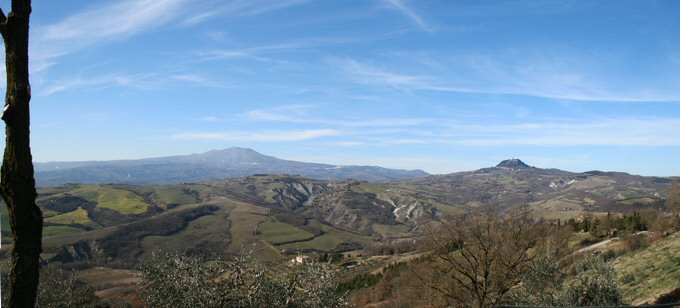
Northwest of San Casciano dei Bagni, Celle is situated in a more exposed position and has a different urban and geological configuration.
Historical outline
The existence of a chapel recalling the conversion of St. Paul is testified in the "Rationes Decimarum" of 1275-1277 and is documented in the statutes of the community of Celle in 1471.
Acording to Repetti, the origin of Celle's castle is unknown but the name seems to be derived from sacred cells or wine cellars, the numerous caves to be found under the village. Carved out of the tufa and used as hiding places in times of war during the bombing, they are used today in some cases as wine cellars.
Early documents prove the existence of Celle in the 13th century in the official records relating to disputes between the Comuni of Siena and Orvieto over the ownership of castles to the southeast of Mount Amiata.
Passing from the jurisdiction of the Comune of Orvieto to the ownership of the Visconti of Campiglia, "Castrum de Cellis" was owned by the Salimbeni family at the end of the 14th century.
The important act by which Siena granted protection to Celle in return for obedience is dated 1418. The statute would then have been modified in 1471 and presented characteristics of greater autonomy, justified by the geographical distance from the Comune of Siena.
Its location in a border area, the frontier in the Middle Ages between Orvieto and Siena and, in the modern era, between the Pontifical State and the Grand Duchy of Tuscany, justifies the interest, which it has always had in previous epochs. The fact that the Via Francigena passes through this territory makes it an obligatory resting point for travellers and for the taxes levied on merchandise in transit.
Visiting the village

When you go through in the main gateway you will notice a particular characteristic of the urban structure in that its perfectly straight streets all meet at a square, which is too big in relation to the actual dimensions of the village. This structure, of rectangular form, has led to the hypothesis that the medieval castle may have been built on an earlier Roman or Lombard fort.
Hardly anything remains of the medieval walls. Of the three gateways into the village and the three corner towers, only one remains and is today the bell tower, which is situated in the main square. The numerous buildings with their Renaissance portals and coats of arms in travertine are of special interest in that they are an indication of their former owners, the rich landed gentry.
In the village you will see the Church of St. Paul the Converted, the patron saint, whose portal and main altar come from the earlier Church of St. Elizabeth, which was destroyed in the earthquake of 1933 and fell into total ruin in 1992. Two more churches can be found in the village, the Church of St. John and the Church of Madonna delle Grazie.
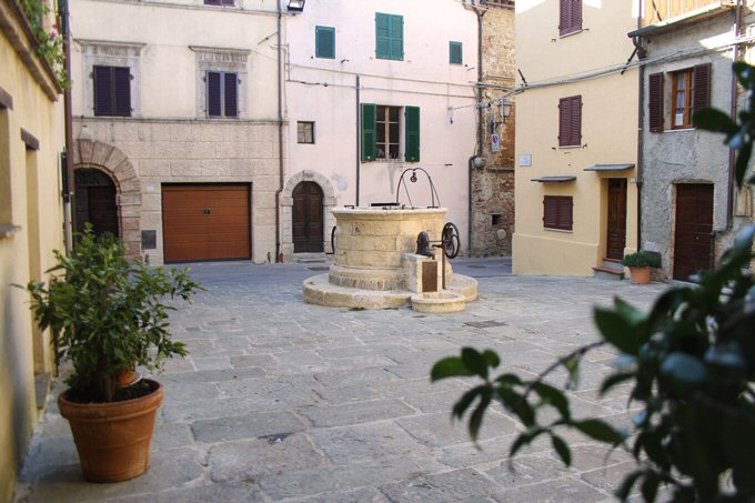
Also interesting is the 16th century "fattoria" (the residence of the governor) left to the parish by the Counts Bocchi Bianchi. There is also the characteristic Piazza del Pozzo where you can still find an ancient well on which are incised the names of the priors who restructured it in 1610.
Since the beginning of the century a landslide has been eroding a part of the village, taking with it all the houses in the south west of the main square. Consolidation work has started in recent years in an attempt to stop this phenomenon due to the geological nature of the land (tufa) rich in water. At present the water is channelled and conducted into small collecting basins while great cement walls have been built to sustain the landslide prone face. There are, however, serious doubts about the resolution of the problem.